
Lower Dolpo Trek
Itinerary
Kathmandu is simply a beautiful place. Once you land at the airport in Kathmandu, your guide or somebody from the travel team will meet you at the exit point of the airport. He will greet you with a warm smile, a hospitable Namaste, and a welcoming hug.
Soon, you will be accompanied to your hotel through the winding alleys of Kathmandu, which is quite a labyrinth for those who are unaware of the artifacts and uniqueness of the streets in Kathmandu. It will be a nice drive to your hotel.
Freshen up and if you become ready to hang out then, the marketplace of Thamel is the best place. There are also several food vendors around, selling mouth-watering foods to the customers.
A flight to Nepalgunj is an interesting way that takes over just an hour to finally reach there.
By the time you arrive at Nepalgunj, you will see a completely different world: new landscapes, new people, a new language, new culture, new weather, and new markets. The temperature is always high in the summer. Plus, you can barely see the hills around.
In the evening, dealing with the mosquitoes, and sometimes bedbugs can be annoying. So, it is better to carry some mosquito-repellent cream or anything to avoid these parasites
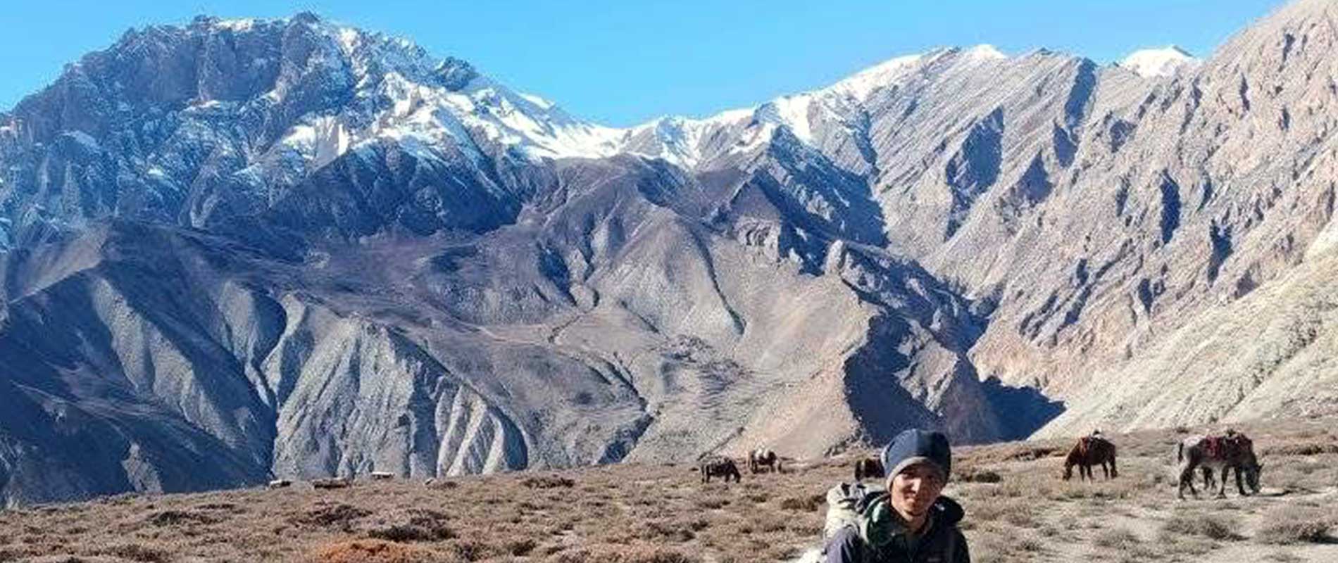
From Nepalgunj, it takes around 25-30 minutes to arrive at Juphal, which is the entry point to the Dolpo region. Before landing, you will come across some of the exquisite vistas of silvery-white mountains, particularly of Dhaulagiri in the east and Kanjiroba Himal in the northwest.
Also, the deep gorges are an important part of the Dolpo. The stunning cliffs of rocks and stones appear as tiny as the dumplings (of varied shapes), spread randomly on a plate.
Soon after we land at the airport, we will have tea at Juphal. Then, along the trail fenced by the maize fields, we will proceed to Dunai. The trail runs parallel to the Thulobheri River until we show off at Dunai, a nice and quiet village where apples are grown. This is why I prefer to call Dunai “an Apple town” despite that it is not a town.
Following the Bheri River, traveling east (sometimes southeast), we will waver up and down along the changing terrain of Dolpo towards the Tarakot. Few sections in the trail are exposed and some of them run steep; otherwise, the trail is not so taxing.
After Byasghar, we will walk through a Bon Monastery near Baijibara. The stone walls, built around the fields, are the inkling of arrival at Tarakot. However, to arrive at the Tarakot, we still need to climb a short uphill section.
While the lodges are available at Tarakot, many people prefer camping there.
From Tarakot, we will walk on the southern bank of the Thulobheri River until Laisicap, where the river divides into two: Bharbung Khola and the Tapap Khola. Bharbung Khola leads east to the unexplored valleys of Dolpo; however, instead of going along the Bharbung Khola, we will keep ourselves on the west bank of the Tarap Khola.
Within a few hours of walking, you will arrive at a point where the views of the Dhaulagiri and Churen Himal begin to show off. Across the river, we could see the monastery of Chhedhul. We will walk along the path until we arrive at the Laina Odar, where a beautiful waterfall cascades furiously down to touch the soil.
A trek to Nawarpani from Laina Odar is a long walk along the sinuous route that is full of amazing surprises. Sometimes, it is the mountains that sprout up the horizon to startle you, while other times, it is just the elegantly positioned rocky cliffs that create an animation in the air. This walk is worth of the entire endeavor.
Through the Chhyugar, we will escape the seemingly invincible cliffs to arrive at the Nawarpani. Although there are not many good views to see, Nawarpani is still a perfect place to spend a night
For the first few couple of hours, the trek to Dho Tarap is literally uninteresting as there are no compensating views while climbing on a few sheer-like slopes on the way.
The trail runs by the side of the Ghyamghar where there is a beautiful monastery that remains closed on most days of the year. We will continue our walk through Sisaul, battling with the heights of the uneven rocky slopes. By the time we arrive at Langa, we could see a short rising hill, climbing which we could descend to Dho Tarap, the first settlement that epitomizes the cultural and natural beauty of the Dolpo region.
A unique set of chortens, wrapped by prayer flags, gives color and warmth to the village of Dho Tarap. These set of chortens appear so organic and natural that you will realize that you have gone very far into the time, at least far enough from the modern world.
Besides Chortens, there are also monasteries to see, whose interiors and exteriors are lavished with paintings of several Buddhist deities. A few distances ahead, near the exit point of the Dho Tarap, there is a Kani Gate featuring 8 sacred symbols on its four sides. It is indeed a wonderful place to stay.
You may go for a side trip to Shipchok and Dhoro Gompas
A trek to Numa La Base Camp is full of excellent muses. This day can be called a “cultural trek day “as you will come across some of the elegantly designed chortens and monasteries on the way. While not all them will be open, there are still enough monasteries to enter and stumble across.
We will leave the Dho Tarap early in the morning and proceed towards the traditional village of Tokyu, which features some of the peculiar monasteries of the Dolpo region, quaint houses, and also some of the unique Kani Gates. Through this village, we will cross the river to Kanger and then, continue along a never-ending steep slope until we arrive at the Numa La Base Camp. On the way, we could see the rocky faces of Numa La pass.
As it happens while crossing most of the high passes, this day is not going to be an easy one. The climb to the Numa La pass will let you know what it means to grab a perfect view.
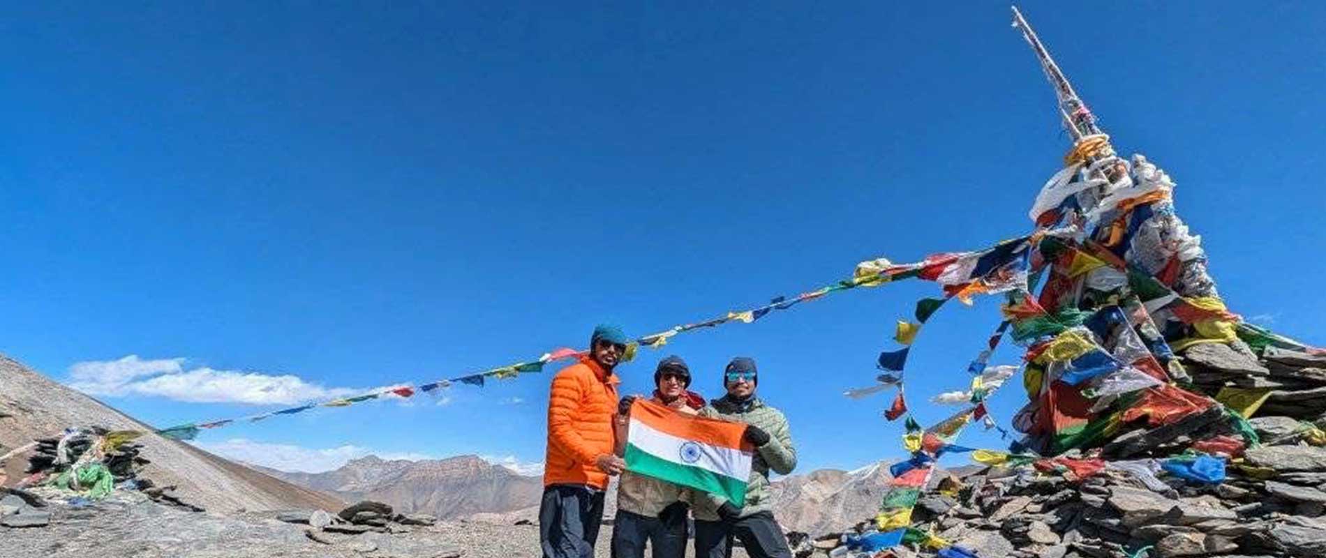
Early in the morning, we will leave the base camp and proceed towards the Danigar along the steep slopes. The trails are now narrow and exposed, so it is quite a threatening ascend. Once you reach the massive height of the Numa La pass, the views are all yours.
The colorful prayer flags, wrapped over the stones, are mostly torn by the pace of the wind, but still one can enjoy its flapping movement. From there, the views of the Dhaulagiri and Churen Himal are unbiased and ravishing. The moments spent on the top of the pass are reminiscing.
Then, we will make a painful descent to Danigar, which will be our next stop-over for the night.
Although not as difficult as yesterday, this day is not going to be an easy one either.
From Danigar, we will take a short steep ascent, and then the altitude gradually rises to the Bagala La Pass. There are a few chortens and Buddhist stones (worshipped stones) on the pass that are kept to ward off the spirits and demons. It is an exciting place to sit.
From Baga La pass, we will go down to Temche.
Just south of the Temche, there is a Chhoital Lake which is beautiful and appears turquoise in the winter. We will descend to the Yak Kharka and then to the Maduwa through the rewarding forests of pines, juniper, and cypress.
Far below, we could see a winter village of Ringmo. After this viewpoint, we will descend along the interesting trail where the views are blocked by the high but beautifully shaped rocky spires. Witnessing the highest waterfall, we will arrive at the Ringmo.
Leaving a spare day for exploration at Ringmo is worth everything. While there is not much to see except the Phoksundo Lake, the supporting rocky buttresses and far-rising snow spires create a defying outlook.
The climb to the Phoksundo Lake can be taxing, but once you are there, the views are all yours. Everything around appears so dramatic and vivid. This Phoksundo Lake is the deepest and second largest lake in Nepal, which appears turquoise in color.
Regarding the formation of this lake, the geologists believe that a massive landslide occurred in the past and blocked all the water of Phoksundo Khola (river) resulting in the formation of the Lake. On the other hand, the people of Dolpo believe in the mythical existence of this lake
It is a nice walk to Shyanta. We will descend to the Samduwa and cross the Pugma Khola. Then, keeping to the east, we will walk to the Rechi where the views of the Kanjiroba (Kanjirowa) Himal appear sensational. This view doesn’t last long, once we start descending to Chhepka.
Parallel to the river of Phoksundo, the trail enters into a tranquil forest, flaunting some of the unique species of birds and insects. One can hear the melody of the chirping birds while on the way. It is a natural walk. Then, down the bluff, we will arrive at Chhepka.
Shyanta is just a few kilometers away from Chhepka.
Along the Suli Khola, we will descend to Kageni and then to Rupgad via a newly built bridge. We may as well turn east and then contour through the Juphal, but it is not worthy of anything as we have already spent a day in Dunai.
Juphal will arrive within a few minutes from Rupgad.
We will catch a return flight to Nepalgunj, and then on the same day, we will return to Kathmandu by another flight.
Overview
The time has come to walk beyond time.
It becomes quite obvious to say that the trek to Lower Dolpo is a rural trek. You will be miles away from the hustle and bustle of the city. No Internet, no calls, no messages, or to be general, no communication with the outside world. You will be venturing into the past, a complete journey in the wild.
Lower Dolpo is a circuit trek that takes you around the exquisite high passes of Dolpo, overlooking the gorgeous barren landscapes and the inspiring mountains of Dhaulagiri, Churen Himal, and the Kanjiroba Himal. The gigantic waterfalls and the placid lakes of Phoksundo and Chhoitai are astounding enough to keep you in awe, at least for a few seconds.
As beautiful are its natural gifts, the trek to Lower Dolpo presents an array of unique Buddhist monasteries and the chortens. People of the Dolpo are spiritually connected with these monasteries. Their purpose and their perspectives are motivated by their Buddhist beliefs and understandings. Many of the chortens can also be found on the high passes, which are kept to ward off the evil spirits and demons.
Planning:
Trekking in Lower Dolpo, a remote and unspoiled region of Nepal, demands precise planning and preparation. Begin by researching Lower Dolpo and its walking routes extensively. The Lower Dolpo Circuit Trek is a popular option because of the variety of scenery and cultural contacts. Understand the trek's difficulty level, as it encompasses high elevations, which necessitates physical fitness.
Perform cardiovascular and strength training activities before your expedition. Make sure your schedule includes modest altitude climbs to allow for adequate acclimatization and to reduce the risk of altitude sickness. Pack accordingly for the difficult terrain and high elevations. Warm clothes, a down jacket, thermal layers, waterproof gear, suitable walking boots, trekking poles, a first aid kit, water purification tools, a detailed map, and a torchlight are all required.
The Best time to do the Upper Dolpo Trek:
The autumn season (September-November) is considered the best trekking season, with consistent weather, bright skies, and little rain. The temperatures during the day are comfortable, allowing for great visibility of the surrounding mountain panoramas and lush surroundings. Trails are frequently dry, making for pleasant walking conditions.
Similarly, the spring season (March-May) brings a burst of color with blossoming wildflowers and vivid rhododendrons, accentuating Lower Dolpo's natural splendor. While daytime temperatures are pleasant, expect frigid evenings at higher elevations.
Seasons such as monsoon (June to early September) and winter (Dec-Feb) are not recommended for this trek because monsoon brings heavy rainfall to the region, making trails muddy, and winter is extremely cold, with temperatures plummeting well below freezing and trails becoming slippery and treacherous, causing difficulty for trekkers.
Food and accommodation:
Lower Dolpo, Nepal's isolated and beautiful region, has housing and culinary options that match the area's seclusion and difficult terrain. Trekkers can anticipate simple but necessary amenities to meet their requirements along the way. Teahouses and lodges, many of which are family-run, are spread throughout the hiking paths, providing modest rooms with minimal bedding.
While some lodgings may have attached toilets, sharing restrooms is more frequent. Camping is an option for those looking for a more immersive experience, but it requires carrying your own camping gear, including a tent and sleeping bag, to deal with the high-altitude and freezing weather.
Teahouses and lodges provide a limited selection of local and basic foreign fare. Trekkers may enjoy traditional dishes like Dal Bhat (a substantial rice and lentil soup), noodles, Tibetan bread, and seasonal vegetables. Because of the logistical hurdles of acquiring food in this distant location, meat alternatives are limited.
(It is always recommended to consult with your guide for hygienic and better food choices)
Transportation:
The most common method to get to Lower Dolpo is to fly from Kathmandu to Nepalgunj on a domestic aircraft. Nepalgunj Airport serves as a main hub for flights to western Nepal. You may take another domestic flight from Nepalgunj to Juphal, which serves as the entryway to Lower Dolpo. Once you reach Juphal, the trip will officially begin and continue from there. This area has a network of hiking paths connecting several settlements and attractions.
This hike will end after we return to Juphal from Shyanta, where we will catch a domestic flight back to Nepalgunj and then another flight back to Kathmandu.
Necessary Permits and TIMS:
Lower Dolpo is a rural and culturally rich area in Nepal's northwestern province. As a result, this area is designated as one of Nepal's restricted zones, and several sorts of licenses are required to enter it. These permits may only be obtained through licensed agencies, and no freelancers are authorized to get them.
1. Lower Dolpa Special Permit:
Lower Dolpa, like Upper Dolpo, is a restricted area, and all foreign tourists must have a Lower Dolpa Special permit to access this region. This permit may be obtained from a certified trekking agency in Nepal, and it normally needs a minimum of two trekkers in a group.
Cost: USD 20 per person for a week plus an additional USD 5 per person /day after a week.
2. Shey Phoksundo National Park Entry Permit:
Shey Phoksundo National Park also includes Lower Dolpo. You will need to secure entry permission to access the national park, which may also be done through a recognized trekking service in Nepal.
Cost: Nrs 3000 per person and no extra charges for additional days.
(All the permits are included in this package)
Necessary documents for Permits:
- 2 Passport-size photos
- One scanned photograph (to be uploaded for RAP's online form)
- Photocopy of your passport (with at least six months validity)
- Travel insurance papers (includes helicopter evacuation of up to 6000m)
- Nepal tourist visa and original passport (required for Department of Immigration, Nepal)
Highlights
- Encounter the traditional Tibetan culture and lifestyle of the Dolpo people.
- Visit spiritual monasteries.
- Interact with friendly locals in remote villages like Ringmo, Tarap, and Dho Tarap.
- Journey through a protected area with unique flora and fauna.
Cost Details
- Airport pickup and drop service.
- Accommodation in Kathmandu 3 Nights (Hotel Chhimeki)
- All Foods (LDB) during trek.
- Accommodation during the trek.
- Transportation costs: Comfortable Drive from Kathmandu to Trek Starting Point and Trek Ending Point by flight, Local Jeep, or bus local bus.
- Government Licence holder English speaking guide.
- Porter (1 porter for 2 trekkers with a max load of 17 to 20kg) along with their salary, lodging, food, and insurance.
- Trekking Permits: Lower Dolpo Special Permit (10 days only)
- Conservation Permit and TIMS card.
- First aid medical box.
- All required trekking gear like sleeping bags and down jackets made available on rent.
- T-shirt, Duffel Bag, and Trekking Map.
- Rescue Management Service.
- All Tax. (13% VAT and 10% Service charge)
- Farewell Dinner.
- All kinds of Drinks
- Visa fee to enter Nepal
- International flight tickets and extra baggage charges
- Extra night accommodation and meal costs in Kathmandu due to any change in the scheduled itinerary
- Travel insurance/ Rescue operation costs
- All personal expenses (laundry, electronic device charging cost, etc)
- Tip for guides and porters
- If you hire horse on the way is cost extra.
Dates & Pricing
Trip Start and End Point
Kathmandu / Kathmandu
| DATES | STATUS | PRICE | SPACE LEFT | ||||
|---|---|---|---|---|---|---|---|
|
Start date: 16-Aug, 2026
End date: 31-Aug, 2026 |
Guaranteed | USD 2850 |
2
|
Book Now | |||
|
Start date: 25-Sep, 2026
End date: 10-Oct, 2026 |
Guaranteed | USD 2850 |
2
|
Book Now | |||
|
Start date: 05-Oct, 2026
End date: 20-Oct, 2026 |
Guaranteed | USD 2850 |
2
|
Book Now | |||
|
Start date: 07-Nov, 2026
End date: 22-Nov, 2026 |
Guaranteed | USD 2850 |
2
|
Book Now | |||
Equipment List
- Woolen shirts and thick sweaters.
- Jackets (Fiber or down).
- Waterproof jacket with hood or poncho.
- Tracksuit, Track shoes and Trousers.
- Thermal Underwear and Thermal coat.
- 2pair of loose fitting long shorts/ skirts.
- Pair of Gloves and sandals.
- Woolen hat and Long sleeved shirt.
- Light weight walking boots.
- 2 pairs of thin socks and 2 pair of woolen socks.
- Snow glasses and sunglasses.
- Trekking Sticks and Duffle bag or kit bag to carry to gear while trekking.
- some (small/large) plastic bags to separate clean clothes from dirty ones and some smaller plastic bags to dispose garbage.
- Daypack bag to carry your personal requirements.
- Water Bottle, water purifying tablets.
- Towels, Umbrella (optional).
- Head lamp, Binocular, Camera, trekking map and compass, reading materials, pencil, rubber, pen, notebook and moisturiser for (lip, face body)
FAQs
The Lower Dolpo region is known for its dramatic landscapes, ancient Tibetan culture, and remote wilderness, featuring stunning sights like Shey Phoksundo Lake and high-altitude desert terrain.
The trek takes you through deep valleys, rugged cliffs, alpine meadows, and barren highlands, with breathtaking views of Kanjirowa Himal and the turquoise waters of Phoksundo Lake.
Lower Dolpo has basic teahouses in some villages, but trekkers should be prepared for camping in remote areas, as lodges are not always available along the trail.
The region is home to Tibetan-influenced communities where you can explore ancient Bon monasteries, yak caravans, traditional farming villages, and the unique customs of the Dolpo-pa people.
Unlike mainstream trekking routes, Lower Dolpo remains untouched and less crowded, offering an authentic Himalayan adventure with raw natural beauty and cultural richness.
Trip Gallery


Leave Your Review
Related trips you might interested in
Short Everest Base Camp Trek
Luxury Tour in Kathmandu
Kathmandu Nagarkot Bhaktapur Tour
Kathmandu, Pokhara & Sarangkot
Kathmandu, Pokhara, and Chitwan Tour
Kathmandu, Pokhara, Australian Base Camp
