
Manaslu Circuit Trek
Itinerary
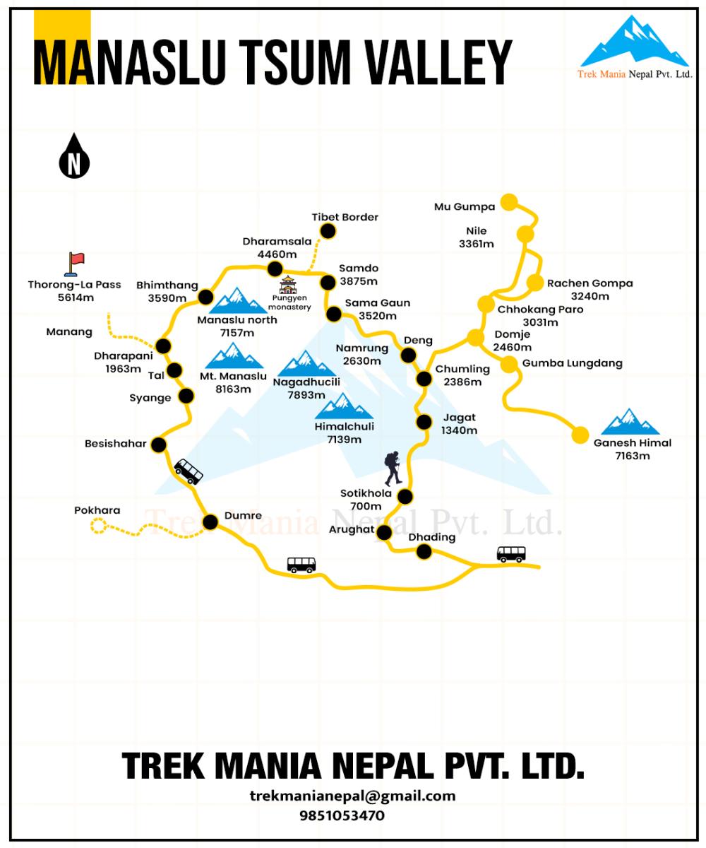
We commence our Manaslu Circuit Trek with an early morning drive to Machhekhola in a Deluxe bus along the Trishuli River and Budi Gandaki River. This drive will pass through charming villages, and lush green valleys, and travel with local people. When we reach Machhekhola we can enjoy the views of the riverside. Stay overnight at the Lodge.
Out of two routes that leave from Machhakhola, we will choose the easier course and walk through the hallucinating trail, fenced by marijuana plants on both sides, until arriving at the Khorlabesi. From there, we will drop into the gorgeous ravine of Budhi Gandaki River and continue along the ancient yak caravan routes. The exotic large black rocks, sometimes overhanging, create a perfectly natural setting.
Soon, we will enter the Tatopani and venture across more exquisite waterfalls, cliffs, and farm fields before entering the village of Dovan. It is a nice village offering fleeting glimpses of the Manaslu and other anonymous ranges. We will continue our journey through the Yaruphant to arrive at the Jagat, where there is an entry checkpoint of the Manaslu Conservation Area Project (MCAP).
Our day starts by crossing a rocky bluff to the village of Salleri, a nice and quiet village of Manaslu. The trail then goes along the west side of the Budhi Gandaki River, with fabulous views of the Shringi Himal and the Langju Himal. We will then, cross the village of Sirdibas to make an appearance at the Ghatte Khola. We will pass by several Chortens and typical Buddhist monasteries before arriving at the prosperous-looking village of Philim.
From Philim, Deng is still 4-5 hours away. Through the isolated village of EkleBhatti (meaning one house), we will head up to the suspension bridge across the Budhi Gandaki river and pass through the sub-tropical forest leading to the Pewa village. A big and vibrant Kani gate, with the paintings of the few Buddhist deities, welcomes us to the village of Deng.
Phedi through the quaint village of Rana. But, you will never really know when you came and left the Bihi Phedi because the village itself is divided into three separate clusters of houses.
For the first few couples of hours, we will catch a steep ascend to Bihi Phedi and then drop to the Ghap along the zigzag trails. On the way, the rewarding monastery of Serang will entice us with the delicate paintings and carvings of several Buddhist deities- Guru Rinpoche, Sakyamuni Buddha, and Chenresig. There are beautiful Chortens to see and farm fields to pass by before arriving at the Ghap.
The surprises are still in stock. On the way to Namrung, we will walk through a pleasant forest of lichens and pines before entering into the serene village of Namrung. To describe Namrung in a phrase, we can call it a "Nepali version of Tibet" as you will get to witness the Tibetan cultures, rituals, and languages firsthand.
It is going to be a nice day today as you are about to venture across some of the exquisite villages and monasteries on the way.
First, we will pass by the farming village of Banjam, where vegetations are cultivated all around the year in the sloppy hills by forming terraces. Banjam also offers good views of the Ganesh Himal and other few glaciers. We will continue to another nice village of Lihi, where there is a small monastery (almost always closed) and a three-leveled chorten painted by the images of several Buddhist deities.
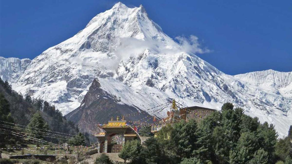
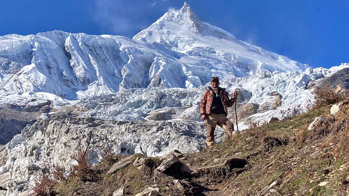
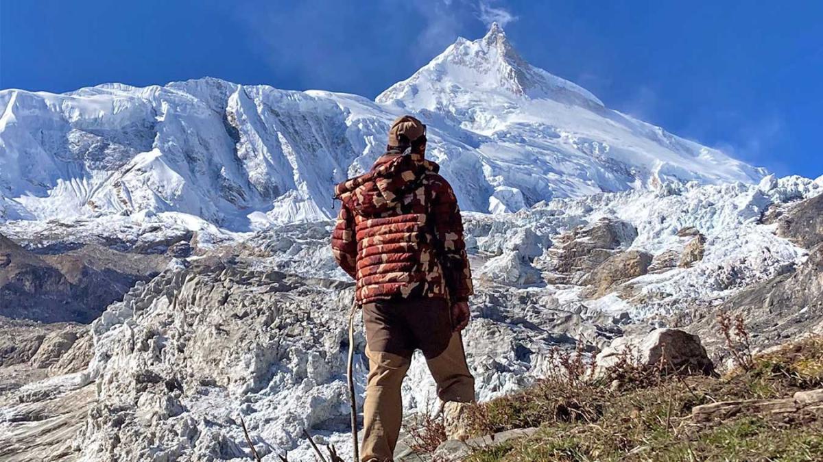
Through the Hinang Monastery, we will proceed to the village of Sho, a place with a big prayer wheel. We will cross the river valley at Sho before showing off at Lho, which offers unparalleled views of the Manaslu ranges.
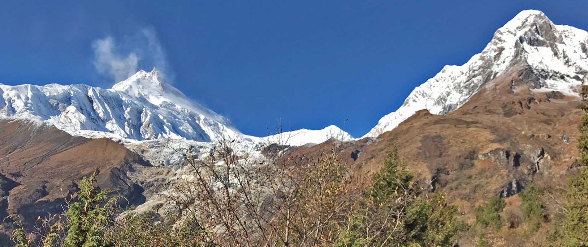
From Lho, the trail passes through the forest of alpine vegetation, which, in the past, used to be the ancient yak caravan routes for exchanging timber with Tibet. The fleeting glimpses of the ridge of the Ngadi Chuli will keep up its glorious magnetism throughout the walk. We will pass by several ancient monastery complexes- typically the Hongsangbu Monastery- which is a typical Tibetan monastery.
It takes 2 hours to reach Shyala and from there, the views are even more enticing. An icy river, which we will come across on the way, is a cool place to stay. About 45 minutes away, there is a junction leading to the Pungyen monastery. But we will continue the downhill section to Samagaon, without stopping by in the middle.
A day trip to Pungyen Gompa is worth of step you take.
First, we will retrace our steps back to the junction (as discussed in Day 6) and head northwest towards the Pungyen Gompa. A small chorten on the way will encourage you to continue your journey until you see another small chorten, of a similar kind. The ascent is relatively easier than the descent.
But, as we cross the 3rd chorten, you will begin to feel the altitude pressure. It is when you should calm down and head up calmly. Himalchuli, Shringi Himal, Ngadi Chuli, and Manaslu are a few of the ranges that add flavor to the journey during the ascent. There is also a small pasture, on the way, that shows another trail to the top of the hill. It is worth going up the hill to witness the green lake of Pungyen Tal and a few of the dead glaciers on its side.
By the time we arrive at the Pungyen Gompa, we will check out its periphery and the arts around it. This monastery is in itself a representation of a typical Buddhist monastery of the Kagya-pa sect. The surrounding views of the glaciers are truly astonishing.
This is another interesting day in the Manaslu region but be aware of the altitude. The more you ascend to Samdo, the more you feel the effects of the altitude. It is better to slow down your pace and head calmly.
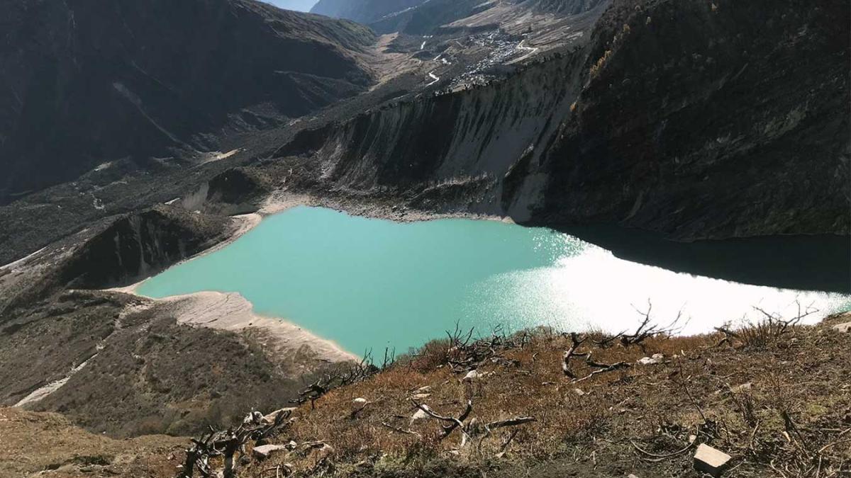
From Samagaon, Birendra Tal is not very far away. It is a glacial lake that appears turquoise in color because of the decomposition of the glacial matter at the bottom of the lake. The name of the lake, ‘Birendra', comes from the name of the late king Birendra Bir Bikram Shah Dev, who visited this lake at some time in history.
The path is interesting as it goes through the snowy sections of the Himalayas. Skip the trail that goes to the Manaslu Base Camp and proceeds by the side of the Mani walls, overlooking the beautiful Samdo Peak, until you arrive at Samdo.
Note: If you are feeling the effects of the altitude then, it is better to stop-by for one day here before climbing up to the Dharamsala.
While heading to the Dharamsala (Larkya Phedi), you need to be aware of your breathing because nobody knows when the altitude demon will wake up to attack you. The path is mostly ascent until the Dharamsala.
First, we will pass by the ancient market of Larkya Bazaar and then head up to the Larkya Phedi along the fabulous trail, marked by chortens and mani walls. The path sometimes goes through the juniper bushes and other astounding glaciers before again joined the exposed trail. When we reach the Larkya Phedi, we will prepare for the next day. Before heading towards the pass, make sure you are fully acclimatized
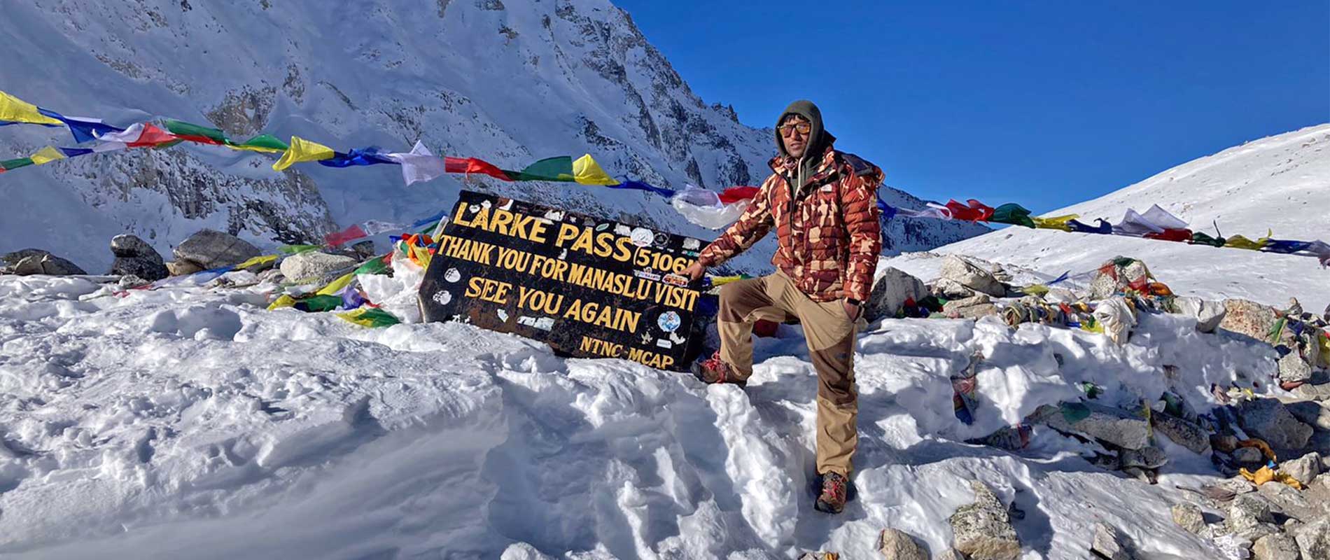
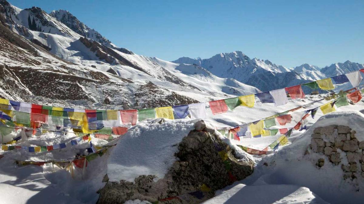
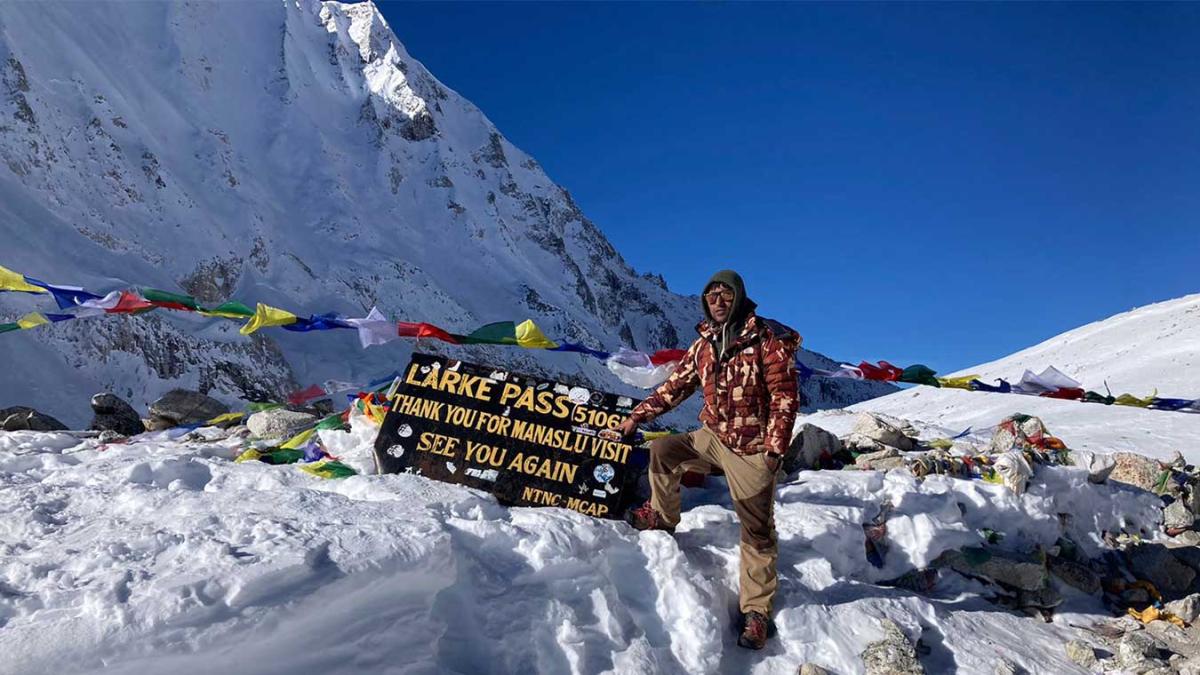
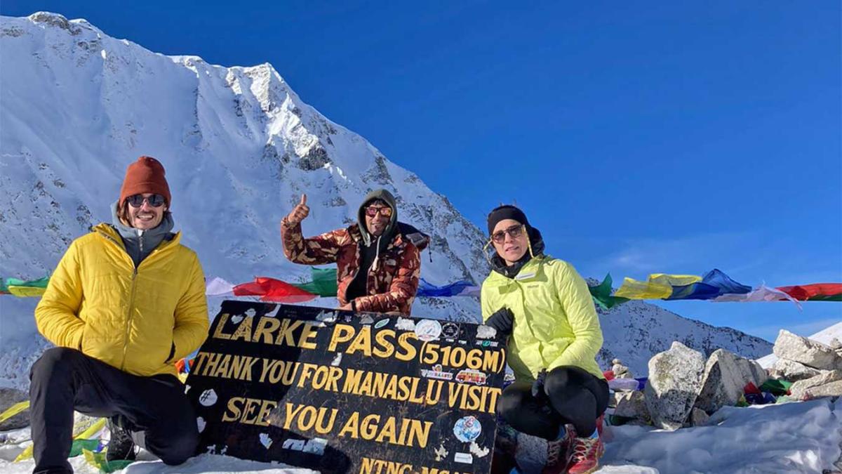
This day is what we have been waiting for so long. Pack up enough food and drinks (must) before heading to the Larkya La pass because it will require you to be strong.
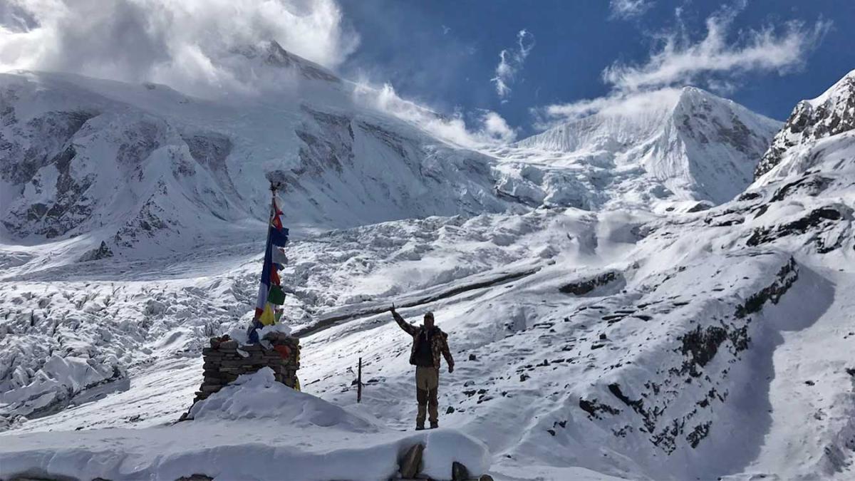
From the beginning of the trek, the mountains and glaciers start to show off. It is when you feel like you are climbing up the mountain. As you walk over the moraine, the side view of the Larkya glacier appears stunning. There are also Chortens and prayer flags, wrapped around the large stones. It is to avoid the evil spirits and demons from the past. By the time we reach the top of the pass, we can capture the stunning views of the North of Manaslu, Syacha glacier, green lakes and several astounding naturally designed icy architectures. The snowfields of Kang Guru and the snowy spires of Annapurna ranges are the magnet of this high pass. Because of the altitude, it is not recommended to stay here for long; so, we will continue down to the Bimthang without a much delay.
Even after descending from the rewarding pass of Larkya La, the views are still sensational at this point. The difference in the views from the Larkya La Pass and the trail to Tilje is the proximity of the mountains. Otherwise, there is no difference at all.
We will continue down the pleasant forest of rhododendrons, pine, oak, and birch, overlooking the stunning peaks and glaciers of the Manaslu. Larkya glacier and the north face of the Manaslu appear prominent at this point. Most parts of the trail are through the forest, so we will again join the forest trail and cross a suspension bridge, spanning across the Dudh Khola River. The icy buttresses of the Kang Guru are still impressive at this point.
We will go down the Yak Kharka to arrive at the Gao or Tilje.
The drive from Gao or Tilje to Besisahar by local jeep is a scenic and adventurous way to descend from the Manang region after completing your trek. This off-road journey follows the Marsyangdi River valley, passing through remote villages, waterfalls, suspension bridges, and dramatic mountain landscapes.
Local jeeps usually operate in the morning and are shared with other travelers. The road is rough and bumpy in several sections, especially during the monsoon season, but experienced drivers ensure a safe and steady ride. As the altitude drops, the scenery changes from alpine terrain to lush hills, forests, and terraced farmlands.
The journey takes approximately 6 to 8 hours, depending on road and weather conditions. Upon arrival in Besisahar, you gain access to hotels, restaurants, and onward transportation to Kathmandu or Pokhara, making it a convenient and memorable end to your Himalayan adventure.
From Tal, we will descend to the Besisahar on foot and catch a long drive to Kathmandu. The route is the same as we have ventured on earlier. Once you return to Kathmandu, you can rest and relax as you wish, or even opt-in for a Trekker's Recovery Massage or other spa services to rejuvenate after the trek. Similarly, people often opt in for a Yoga Teacher Training Course after trekking in Nepal.
Overview
Trekking in Manaslu is in itself an adventure, but we are offering this trek with a little twist in our Manaslu circuit trek itinerary. The trekking package has become more than just an adventure. We are avoiding the customary routes to the Manaslu (which is via Soti Khola) and following the higher highway that runs to the Salyankot. This package is thoughtfully designed to enable the Manaslu trekkers to revel in a unique place in a unique way.
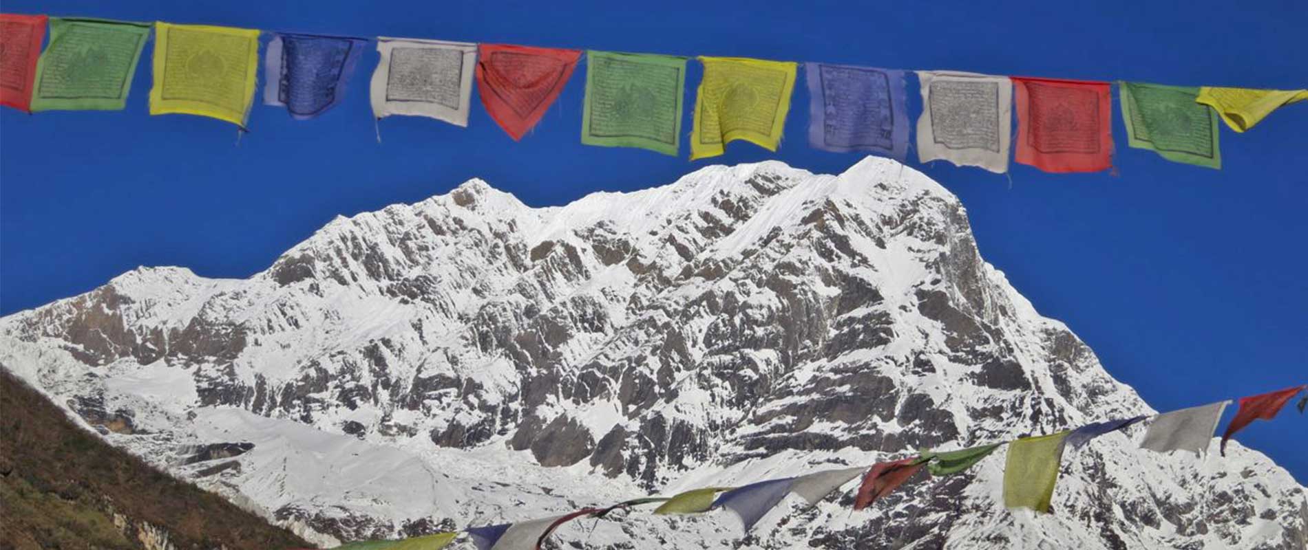
For decades, the high pass of Larkya La has fascinated the trekkers with its immense glory. The mountain views from this point are so sensational that you will begin to fall into the fantasies and the defying glimpses of the mountains. They are truly stupendous. Besides, the colorful monasteries and vibrant shortens, adorned with classic paintings and historical carvings of godly images, have helped Manaslu gain a new identity of spirituality. Visitors come to admire the monastic complexes and traditional stone masonry in the Manaslu. In this particular package, we have added new historical places and their inspiring stories to give you a unique experience in the Manaslu trekking. It is a natural, cultural, and historical trekking package. Check out our itineraries to know more about the places and mountains in the Manaslu Region.
Planning the Manaslu Circuit Trek:
The Manaslu Circuit Trek is an exciting trip, but because of its difficulty, it necessitates meticulous planning. In order to successfully complete a trek, one must obtain the necessary permits, choose the right time of year, create a detailed itinerary, consider hiring a local guide and porter, engage in physical preparation, acquire the necessary gear and equipment, create a thorough packing list, understand how to prevent altitude sickness, purchase travel insurance, ensure access to safe food and water, make arrangements for communication and emergency equipment, budget for costs, and demonstrate responsibility. Safety and adaptation are paramount on this challenging, high-altitude journey over the Himalayas.
The Best time to do the Manaslu Circuit:
Throughout the spring (March to May), this journey delivers an incredible array of colors and scents. The weather continues to be stable, with nice temperatures during the day. Rhododendron woodlands bloom, creating a beautiful backdrop for your walk. Clear skies are typical, providing unobstructed vistas of the towering peaks.
Autumn (September through November) is another fantastic season. This period follows the monsoon season and has dry and consistent weather. The monsoon rains have made the walkways lush and verdant, adding color to the surroundings. The sky is always clear, giving for stunning vistas of the mountains. The cool yet temperate temps provide for great trekking conditions.
The Manaslu Circuit Trek is not recommended during the monsoon or summer months (June, July, and August). Furthermore, the winter cold (December, January, and February) is unbearable for the ordinary hiker.
Manaslu Trekking: Food and Accommodation:
Your food and lodging are mostly supplied by Teahouse or guesthouses throughout the Manaslu Circuit Trek. These lodges provide a variety of lodging choices, from modestly nice rooms with attached bathrooms in certain locations to simple rooms with communal amenities. The rooms don't have upscale facilities despite frequently having double beds, comforters, and heating stoves in them. Teahouses during our Manaslu trekking provide a range of meals, including some foreign selections and traditional Nepali fare like Dal Bhat. Additionally, you may discover common foods like spaghetti, noodles, and pizza. To lower your chance of contracting a foodborne illness, choose vegetarian meals. It's also a good idea to include snacks and energy bars for on-the-go refueling.
It is also recommended to consult your guide for better and hygienic options.
Transportation used for Manaslu Trekking:
The hike usually begins in Maccha Khola(starting point). Our journey begins in Kathmandu, where a public vehicle (shared Jeep) will take you to Maccha Khola which will take around 9 to 10 hours, depending on the route and road conditions. You may alternatively choose a private vehicle (4 hours), which goes significantly faster but is not included in this plan, thus an additional payment will be applied.
Our trip officially begins when we reach Machha Khola. From here, we'll continue on foot along the Manaslu Circuit Trek path. As you make your way towards Lho, Samagaon, and other significant destinations on the trip, you will pass through diverse villages, terraced fields, woods, and finally higher heights.
Our journey will come to a conclusion at Jomsom, from where you may fly back to Pokhara or take a Jeep ride that would take 8 to 9 hours, depending on the state of the roads.
Necessary Permits & TIMS:
The Nepali government recently decided to outlaw solo travel in the Manasalu Region (between Jagat and Dharapani) to reduce tourism. As a result, individual trekkers are prohibited from entering Manaslu, and those who wish to do so must get entrance permits. Additionally, the government has passed laws requiring that at least two hikers in a group always have a local guide with them.
To help with conservation efforts and to allow you access to the restricted region, three different types of permits are needed at this place. For this trip, a TIMS permission could also be necessary. These permissions must be handled by an authorized organization.
(Freelance guides are unable to obtain the appropriate permissions for the Manaslu Circuit.)
1. Manaslu Conservation Area Project (MCAP):
Before entering the Manaslu region, you must first get a Manaslu Conservation Area Project (MCAP) Permit. In order to enter the Manaslu Conversation Area from Philim, you must have this permit.
Cost: Nrs 3000 per person. There are no restrictions or pricing changes based on the number of days spent inside MCAP.
2. Annapurna Conservation Area Project (ACAP Permit):
An ACAP Permit is required to enter Nepal's Annapurna Conservation Area (ACA) for trekkers and tourists. From Dharapani until the time you exit ACAP in Beshi Sahar, this permit is necessary.
Cost: Nrs 3000 per person. There are no restrictions or pricing changes based on the number of days spent inside ACAP.
3. Special Restricted Area Permit for Manaslu (RAP):
The Nepalese government has granted the Restricted Area Permit (RAP) for Manaslu, a legal document that enables trekkers to enter and trek through particular restricted regions, including the Manaslu region. From Jagat to Sama Gaun, this Manaslu trek permit is necessary. You also need this permission to enter Tsum Valley.
Cost: USD 100 per person for the first seven days (September to November), plus an additional USD 15 per person per day starting on the eighth day. Whereas USD 75 per person for the first seven days (December to August) and an additional USD 10 per person per day commencing on the eighth day.
4. Trekker's Information Management System (TIMS):
A Trekker's Information Management System (TIMS) card was required for the Annapurna Circuit Trek. TIMS is essential since it aids hikers in ensuring their protection and safety when traveling over the Himalayas.
Cost: Around Nrs 3000 per person and for SAARC tourists Nrs 1000 per person.
(All the Permits and TIMs cards are included in this package.)
Necessary Documents for Permits and TIMS:
- Passport-size photos, one (For ACAP and MCAP permits)
- One scanned photograph (to be uploaded for RAP's online form)
- Photocopy of your passport (with at least six months' validity)
- Travel insurance papers (includes helicopter evacuation of up to 6000m)
- Nepal tourist visa and original passport (required for Department of Immigration, Nepal)
Other Popular Trekking Trails in Nepal
If you would like to explore other trekking trails in Nepal besides Manaslu Circuit, please feel free to visit our trekking packages in Nepal.
Or if you would like to explore other activities to opt-in before or after this trek, you might like to try Massage and Yoga Teacher Training Course in Nepal.
Highlights
- Enjoy breathtaking vistas of Manaslu and other Himalayan peaks.
- Immerse yourself in the cultures of Gurung, Tamang, Tibetan, and other communities.
- Explore a sanctuary with diverse flora and fauna.
- Visit ancient monasteries along the trek.
Cost Details
- Airport pickup and drop service
- Accommodation in Kathmandu (2night Hotel Chhimeki)
- All food and lodging during the trek (B, L, D included)
- Transportation costs: Drive from Kathmandu to Machhekhola by public bus and Trekking ending Point Tilche to Besishare by Local Jeep and Besishare to Kathmandu by tourist bus.
- Government license holder, English-speaking trekking guide, and his salary, lodging, food, and insurance
- Trekking permits: Manaslu Special Permit (08 days only), Manaslu & Annapurna Conservation Permit.
- First aid medical box.
- T-shirt, Duffel Bag, and Trekking Map with company logo
- Rescue Management Service.
- All Tax (13% VAT and 10% company service charge)
- Farewell Dinner
- International flight tickets and extra baggage charges
- Visa fee to enter Nepal
- All kinds of Drinks.
- Extra night accommodation and meal costs in Kathmandu due to any change in the scheduled itinerary
- Travel insurance/ Rescue operation costs
- All personal expenses (laundry, electronic device charging cost, all alcoholic beverages and soft drinks etc).
- All required trekking gear like sleeping bags and down jackets(available on rent)
- Porter (1 porter for 2 trekkers with a max load of 17 to 20kg) for carry badge.
- Tip for guide and porters
Trip Map
Dates & Pricing
Trip Start and End Point
Kathmandu / Kathmandu
| DATES | STATUS | PRICE | SPACE LEFT | ||||
|---|---|---|---|---|---|---|---|
|
Start date: 15-Aug, 2026
End date: 27-Aug, 2026 |
Guaranteed | USD 1400 |
2
|
Book Now | |||
|
Start date: 20-Aug, 2026
End date: 01-Sep, 2026 |
Guaranteed | USD 1400 |
1
|
Book Now | |||
|
Start date: 25-Aug, 2026
End date: 06-Sep, 2026 |
Guaranteed | USD 1400 |
3
|
Book Now | |||
|
Start date: 07-Sep, 2026
End date: 19-Sep, 2026 |
Guaranteed | USD 1400 |
4
|
Book Now | |||
|
Start date: 11-Sep, 2026
End date: 23-Sep, 2026 |
Guaranteed | USD 1400 |
2
|
Book Now | |||
|
Start date: 21-Sep, 2026
End date: 03-Oct, 2026 |
Guaranteed | USD 1400 |
2
|
Book Now | |||
|
Start date: 03-Oct, 2026
End date: 15-Oct, 2026 |
Guaranteed | USD 1400 |
2
|
Book Now | |||
|
Start date: 05-Oct, 2026
End date: 17-Oct, 2026 |
Guaranteed | USD 1400 |
2
|
Book Now | |||
|
Start date: 05-Oct, 2026
End date: 17-Oct, 2026 |
Guaranteed | USD 1400 |
2
|
Book Now | |||
|
Start date: 08-Oct, 2026
End date: 20-Oct, 2026 |
Guaranteed | USD 1400 |
2
|
Book Now | |||
|
Start date: 10-Oct, 2026
End date: 22-Oct, 2026 |
Guaranteed | USD 1400 |
2
|
Book Now | |||
|
Start date: 15-Oct, 2026
End date: 27-Oct, 2026 |
Guaranteed | USD 1400 |
2
|
Book Now | |||
|
Start date: 21-Oct, 2026
End date: 02-Nov, 2026 |
Guaranteed | USD 1400 |
2
|
Book Now | |||
|
Start date: 26-Oct, 2026
End date: 07-Nov, 2026 |
Guaranteed | USD 1400 |
2
|
Book Now | |||
|
Start date: 29-Oct, 2026
End date: 10-Nov, 2026 |
Guaranteed | USD 1400 |
3
|
Book Now | |||
|
Start date: 05-Nov, 2026
End date: 17-Nov, 2026 |
Guaranteed | USD 1400 |
4
|
Book Now | |||
|
Start date: 08-Nov, 2026
End date: 20-Nov, 2026 |
Guaranteed | USD 1400 |
4
|
Book Now | |||
|
Start date: 16-Nov, 2026
End date: 28-Nov, 2026 |
Guaranteed | USD 1400 |
8
|
Book Now | |||
|
Start date: 18-Nov, 2026
End date: 30-Nov, 2026 |
Guaranteed | USD 1400 |
8
|
Book Now | |||
|
Start date: 22-Nov, 2026
End date: 04-Dec, 2026 |
Guaranteed | USD 1400 |
8
|
Book Now | |||
|
Start date: 24-Nov, 2026
End date: 06-Dec, 2026 |
Guaranteed | USD 1400 |
8
|
Book Now | |||
|
Start date: 26-Nov, 2026
End date: 08-Dec, 2026 |
Guaranteed | USD 1400 |
8
|
Book Now | |||
|
Start date: 30-Nov, 2026
End date: 12-Dec, 2026 |
Guaranteed | USD 1400 |
8
|
Book Now | |||
|
Start date: 02-Dec, 2026
End date: 14-Dec, 2026 |
Guaranteed | USD 1400 |
4
|
Book Now | |||
|
Start date: 04-Dec, 2026
End date: 16-Dec, 2026 |
Guaranteed | USD 1400 |
8
|
Book Now | |||
|
Start date: 08-Dec, 2026
End date: 20-Dec, 2026 |
Guaranteed | USD 1400 |
8
|
Book Now | |||
Equipment List
- Woolen shirts and thick sweaters.
- Jackets (Fiber or down).
- Waterproof jacket with hood or poncho.
- Tracksuit, Track shoes and Trousers.
- Thermal Underwear and Thermal coat.
- 2pair of loose fitting long shorts/ skirts.
- Pair of Gloves and sandals.
- Woolen hat and Long sleeved shirt.
- Light weight walking boots.
- 2 pairs of thin socks and 2 pair of woolen socks.
- Snow glasses and sunglasses.
- Trekking Sticks and Duffle bag or kit bag to carry to gear while trekking.
- some (small/large) plastic bags to separate clean clothes from dirty ones and some smaller plastic bags to dispose garbage.
- Daypack bag to carry your personal requirements.
- Water Bottle, water purifying tablets.
- Towels, Umbrella (optional).
- Head lamp, Binocular, Camera, trekking map and compass, reading materials, pencil, rubber, pen, notebook and moisturiser for lip, face body
Trip Gallery
Travellers Review
Fantastic service
I have just completed the Manaslu circuit trek with Trek Mania!
The booking process was easy, airport pick up was smooth, the hotel and support in Kathmandu pre-trek were great.
I was supposed to be joining a group but other’s flights were cancelled and so I ended up solo with my guide Santosh. He was fantastic from start to finish - making sure that I was comfortable and looking out for my safety throughout the trek. On the more challenging days (Larke La pass day and after falling ill) he even carried some items from my pack to make things easier for me. He obviously has great relationships with the different guest houses along the route as I got extra things (like warm blankets and a private room every night) that other trekkers didn’t.
10/10 would recommend Santosh and the team at Trek Mania!
Manaslu Circuit
Wonderful experience with trek mania on the Manaslu Circuit. Our guides were awesome, we felt really support and safe. I would highly recommend booking with them if you’re looking for a trek!
Made it to Larke Pass
Amazing company, I booked with them and wasn’t disappointed. Made it to Larke Pass and felt completely supported and comfortable through the whole Trek. I was lucky to have a guide called Kumar N and he was very experienced and made sure I was happy and healthy through the whole trip. Wonderful experience and I highly recommend booking with them.

Leave Your Review
Related trips you might interested in
Short Everest Base Camp Trek
Luxury Tour in Kathmandu
Kathmandu Nagarkot Bhaktapur Tour
Kathmandu, Pokhara & Sarangkot
Kathmandu, Pokhara, and Chitwan Tour
Kathmandu, Pokhara, Australian Base Camp
